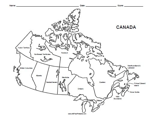
Free Printable Canada Labeled Map. Free Printable Canada Labeled Map, a very useful resource for your classroom teaching activities. Print it free using your inkjet or laser printer. Great free printable to help students learn at geography or history classroom. Use this map for your projects, test, quick review, quiz or homework. Can write the student’s name, date and score. This map includes the Canada Labeled Map only, with divisions. Students can find and learn about Ottawa, Ontario, Alberta, Quebec, Nunavut culture and other great places in Canada. Print all free printable Canada Maps here. Click the link below to download or print the free Canada Labeled Map now in PDF format.
Instructions: Click the print link to open a new window in your browser with the PDF file so you can print or download using your browser’s menu.
Print Canada Labeled Map

