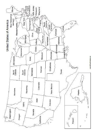
Free Printable United States Map with States Names. Free Printable United States Map with States Names for parents, teachers and students. Print free United States Map with States Names here. Print it free using your inkjet or laser printer. Great free printable to share with kids at school for homework, test study, learning USA States. This map includes the United States Map with States Names including Alaska and Hawaii. Click the link below to download or print the free United States Map with States Names now in PDF format.
Instructions: Click the print link to open a new window in your browser with the PDF file so you can print or download using your browser’s menu.
Print United States Map with States Names


Where is Washington DC
This map identifies only the 50 States. Washington, DC, isn’t a state; it’s a district. The Capital of United States that is located between Virginia and Maryland is not identified in this map.